

Executive Summary: The Closer Hazard Carries the Lower Tier
The route-risk fusion run for 22 October 2026 evaluated sixty monitored route pairs and flagged twenty-six of them. [source-1] Eleven routes into Osaka carry the ALERT tier because of a volcanic ash advisory for Mount Sakurajima in the Fukuoka flight information region, at a recorded distance of 439 km. [source-1] Ten routes into Taipei carry the WATCH tier because of Tropical Cyclone Champi, also in the Fukuoka region, at a recorded distance of 396 km. [source-1] The hazard that sits 43 km closer to its aerodrome is scored one tier lower.
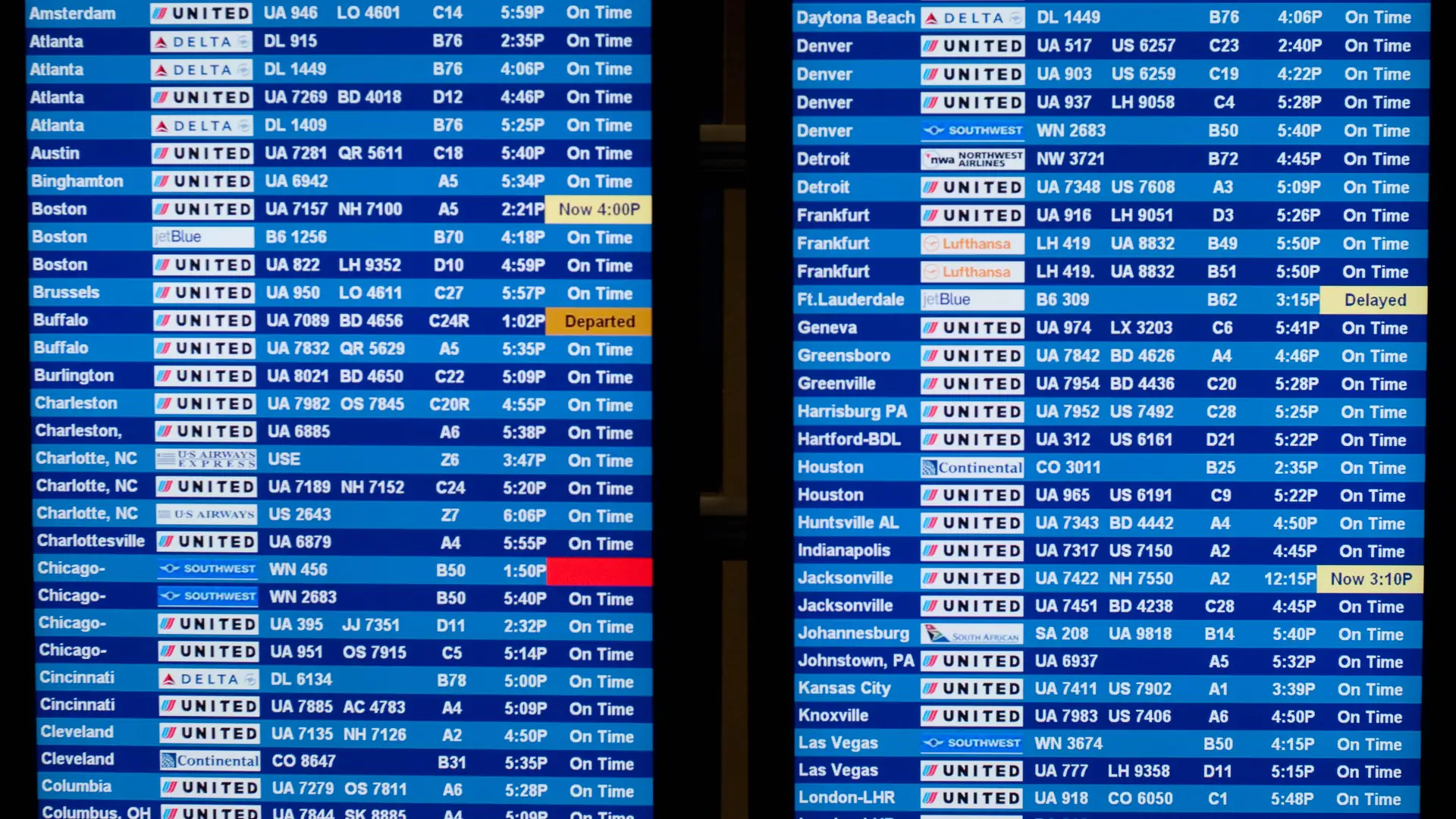
That ordering is not an error, and it is not a story about a mistake in the engine. It is a demonstration of what the tier is. The tier is a classification of a hazard's proximity and class relative to an aerodrome, assembled from SIGMET and advisory records, and it is computed without any reference to whether flights are operating. [source-1] [source-2] On 22 October the Taiwanese authorities issued a land warning ahead of the storm, and press reporting the same day described more than a hundred flights cancelled and winds of 140 mph. [source-3] [source-4] A second report described 200 flight cancellations as the storm approached. [source-5] A Japanese carrier's own weather notice, published at 16:00 JST, listed its Japan and Asia airports as subject to delay, cancellation or diversion because of Champi. [source-6]
Both statements hold at once. The ALERT tier says an ash hazard of a particular class was recorded at 439 km from Osaka. The WATCH tier says a cyclone hazard of a different class was recorded at 396 km from Taipei. Neither statement is a claim about the hundred cancelled flights, and the mistake a reader can make is to treat the tier as if it were one.
1. What the Run Actually Flagged
The fusion run is a single pass over sixty route pairs, checked at 2026-10-22T16:06:34+08:00. [source-1] Its output has three levels, and the distribution across the sixty routes is thirty-four at none, fifteen at watch and eleven at alert. [source-1]
| Cluster | Hazard | FIR of record | Distance to aerodrome | Routes flagged | Tier |
|---|---|---|---|---|---|
| Osaka (KIX) | Volcanic ash, Mount Sakurajima, Aira Caldera | RJJJ Fukuoka | 439 km | 11 | ALERT |
| Taipei (TPE) | Tropical cyclone, Champi | RJJJ Fukuoka | 396 km | 10 | WATCH |
| New York oceanic | Tropical cyclone, Josephine | New York Oceanic | 407 km | 5 | WATCH |
| Any other destination | None recorded | — | — | 34 | none |
Sources: [source-1]
The table is a projection of the run and nothing more. Every row is countable in the output, and the four distances are the values recorded in the reason objects rather than values computed for this article. [source-1]

Sources: [source-1]
One route sits in two clusters at once. JFK-KIX carries the ash advisory and Josephine, and it is the only route in the run with two distinct hazards attached to it. [source-1] Its tier is ALERT, which follows from the ash record rather than from the cyclone, and the combination is a reminder that the tier is assigned from the strongest reason in the list rather than from the list's length.
2. Why the Nearer Hazard Scores Lower
The first explanation to rule out is a defect in the distance measurement. Both hazard records name the same flight information region, RJJJ Fukuoka, and both distances are recorded against the arrival aerodrome rather than against a route midpoint. [source-1] The ash zone is 439 km from KIX; the cyclone is 396 km from TPE. [source-1] The distance ordering is therefore 396 before 439, and the tier ordering is ALERT before WATCH, which is the reverse.
The second explanation is the one the data supports: the tier is not a distance ranking. It is a classification in which hazard class, the region of record and the distance band all contribute, and the classes are not interchangeable. [source-2] Volcanic ash is treated as a hazard that closes airspace, because turbine engines cannot reliably tolerate it and the advisory structure exists to keep aircraft out of the affected volume. [source-7] A tropical cyclone is treated as a hazard that disrupts operations through wind, rain and airport closure, and its effect on a flight is mediated by the airport's own decisions. [source-8] The two hazards have different operational signatures, and a single tier scale has to place them on one axis.
The third point is about direction of travel. An ash advisory describes a volume that aircraft must avoid, and avoidance on a route into Osaka means rerouting around a fixed polygon. A cyclone warning describes a moving system, and its position at the time of the run is a snapshot of a track. [source-8] [source-9] The cyclone record attached to the Taipei routes carries a movement field that reads as unpopulated in this run, meaning the tier was computed from a position rather than from a forecast track. [source-1] A hazard that is moving and a hazard that is not are not the same input, even when both are converted to a distance in kilometres.
None of that makes the ordering intuitive, and the point of publishing the table is that intuition is the wrong instrument here. The tier names are relative to a scoring scheme, and a reader who maps WATCH below ALERT onto "less disruption" has substituted an operational reading for a classification.
3. What the Tier Does Not Encode
The clearest way to see the boundary is to list what is absent from the output. The run records a level, a summary and a reason list per route. [source-1] It does not record a cancellation count, an airport operating status, a notice to airmen closure, an airline decision, a wind speed, or a passenger reaccommodation state. Every one of those variables moved on 22 October, and none of them is an input to the tier.
The weather layer of the same scan does record conditions at the destination, and for Taipei it reads overcast, 23.4 degrees Celsius, an air quality index of 41 and an impact flag of true. [source-10] That is a statement about surface conditions at a point, not about whether the airport is accepting arrivals. A cyclone can produce overcast conditions at a terminal while the aerodrome is closed to arrivals, and the two records are collected for different purposes.
The run also contains a data-quality feature that a reader should know about before counting reasons. Ten of the Taipei routes carry four reasons each, and the four are identical: the same hazard class, the same qualifier, the same flight information region and the same 396 km distance, repeated four times. [source-1] The eleven Osaka routes carry two identical reasons each, and JFK-KIX carries four reasons made of two distinct hazards duplicated twice. [source-1]
| Route group | Reasons recorded | Distinct hazards | Repetition |
|---|---|---|---|
| Ten routes into TPE | 4 each | 1 (Champi) | Same record four times |
| Ten routes into KIX, excluding JFK-KIX | 2 each | 1 (Sakurajima ash) | Same record twice |
| JFK-KIX | 4 | 2 (ash and Josephine) | Two records, each twice |
| Five routes into JFK, ICN, TYO, HKG | 2 each | 1 (Josephine) | Same record twice |
Sources: [source-1]
The practical rule that follows is that the length of a reason list is not a measure of threat. A route with four reasons can carry one hazard, and a route with two reasons can carry one hazard as well. [source-1] Anyone ranking routes by reason count would place the Taipei cluster above the Osaka cluster on a quantity that is an artefact of collection rather than a property of the weather.
4. The Operational Record on the Same Day
The run's snapshot is 16:06:34 on 22 October. The day's reporting describes a storm that had already forced decisions by then.
Reuters reported that Taiwan issued a land warning ahead of the arrival of a powerful typhoon. [source-3] The Independent reported that Taiwan cancelled more than a hundred flights as the storm churned towards the island with 140 mph winds, and described it as a super typhoon. [source-4] A second outlet reported 200 flight cancellations and disruption to US-Japan drills. [source-5] A Manila-datelined report described dozens of domestic and international flights cancelled as Typhoon Bavi affected northern areas while volcanic ash from Mount Kanlaon forced temporary airspace restrictions in parts of the Visayas, which is a separate storm and a separate ash source in the same week. [source-11]
The airline-side record is the most concrete of the four. A Japanese carrier's international flight information page, updated at 16:00 JST on 22 October, listed its Japan and Asia airports as subject to delay, cancellation or diversion because of Typhoon Champi, and stated that no airport in Oceania, Guam, Hawaii, North America, Europe or the Middle East was applicable at that update. [source-6] That is an operator converting a meteorological event into an advisory about its own network, and it is the layer that a traveller can act on.
Put the two records side by side and the tier's position becomes clear. The tier was computed at 16:06 from hazard records; the cancellations were reported during the day; the airline notice was published at 16:00 JST, which is 15:00 in the run's own timezone. [source-1] [source-6] The three records are contemporaneous and they measure different things: hazard proximity, press-reported disruption, and operator advisory.
5. The Price Signal Inside the Same Cluster
The price-window run for the same day adds a fourth layer, and it points in a direction that has nothing to do with the weather. The same sixty route pairs carry fare signals, and the cheapest route in the entire set is PVG-TPE at 80 dollars against a mean of 214.60, a ratio of 0.373, with a month-on-month change of minus 69 per cent. [source-12] That route is inside the ten-route Taipei cluster that carries the WATCH tier. [source-1] [source-12]
The most expensive route by ratio is SZX-KIX at 1.989, with a current fare of 788 dollars against a mean of 396.25 and a month-on-month change of plus 118.3 per cent. [source-12] That route is inside the eleven-route Osaka cluster that carries the ALERT tier. [source-1] [source-12]
| Route | Tier | Current fare | Mean | Ratio to mean | Month-on-month |
|---|---|---|---|---|---|
| PVG-TPE | WATCH | $80 | $214.60 | 0.373 | -69.0% |
| SZX-TPE | WATCH | $192 | $287.50 | 0.668 | -35.1% |
| PEK-KIX | ALERT | $410 | $358.60 | 1.143 | +18.2% |
| SZX-KIX | ALERT | $788 | $396.25 | 1.989 | +118.3% |
Sources: [source-1] [source-12]
Two warnings are required by the measurement itself. A ratio to mean is not comparable across routes with different averaging windows, and in this run two of the Taipei routes were averaged over three months while most were averaged over five. [source-12] And a fare signal is not a statement about availability on a chosen date, so a BUY on a route with a cyclone overhead describes a position in a fare curve, not a bookable seat. [source-13] What the table does show is that proximity to a hazard and position in a fare curve vary independently, and a single cluster can contain both the cheapest and one of the most expensive routes in the network.

Sources: [source-1]
6. How to Read a WATCH Cluster
A WATCH tier on ten routes is a statement that a hazard of a given class was recorded within a distance band of one aerodrome. The use of that statement is to know where to look, and the checks that follow are operational.
- Check the operator, not only the hazard. The carrier notice is the layer that converts weather into a decision about a specific flight, and on 22 October it listed Japan and Asia airports as affected and every other region as not applicable. [source-6]
- Check the aerodrome. A destination with a land warning in force can be closed to arrivals while surface conditions read as overcast. [source-3] [source-10]
- Check the date-specific fare rather than the route average. The cheapest ratio in the network sat on a route with a cyclone 396 km away. [source-12]
- Keep a rebooking channel open on the ground. An eSIM data plan active before departure keeps an airline app reachable when an airport's own network is congested. [source-14]
- Fix the ground leg in advance. A fixed-price airport transfer removes a negotiation from an arrival that may be re-timed by hours. [source-15]
- Preserve the claim if the disruption is the carrier's. Flight compensation applies to a cancellation or long delay that the airline caused, and it does not apply to a weather closure, which is the distinction worth understanding before filing. [source-16]
The last of those is the one most often got wrong in a storm week. A cyclone is ordinarily treated as an extraordinary circumstance, and the entitlement that survives is rebooking or refund under the carrier's conditions rather than compensation under a delay regime. [source-16] [source-17]
7. Conclusion: A Classification Is Not a Forecast
The 22 October run flagged twenty-six of sixty routes, split eleven at ALERT and fifteen at WATCH. [source-1] The ALERT cluster sits around an ash advisory at 439 km. The WATCH cluster sits around a cyclone at 396 km, on a day when more than a hundred flights were reported cancelled and a carrier published a network advisory naming its Asia airports. [source-1] [source-4] [source-6] The nearer hazard carries the lower tier, and both facts are correct within their own instruments.
Two habits follow. The first is to read the tier as a classification of hazard proximity and class, which is what it is, and to look for an operational record elsewhere. [source-2] The second is to count hazards rather than reasons, because the Taipei flags repeat one record four times and a reason count would rank the wrong cluster higher. [source-1]
The tier that describes the airspace is not the tier that describes the airport, and neither of them is the tier that describes a passenger's day. On 22 October the distinction was worth a hundred flights.
📑 Verified Evidentiary References (40 sources) — click to expand
- [1] OSINTRAI 96-node route-risk engine: Sixty monitored route pairs, checked 2026-10-22T16:06:34+08:00, 11 alert, 15 watch osintrai.com/intel/geo
- [2] OSINTRAI Signal Dictionary: Route-risk tier construction and hazard class weighting osintrai.com/intel/geo
- [3] Reuters: Taiwan issues land warning ahead of arrival of powerful Typhoon Champi, 22 October 2026 reuters.com/business/environment/taiwan-is…
- [4] The Independent: Taiwan cancels over 100 flights as Super Typhoon Champi churns towards island with 140mph winds independent.co.uk
- [5] VnExpress International: Typhoon Champi nears Taiwan, causing 200 flight cancellations and disrupting US-Japan drills e.vnexpress.net
- [6] Japan Airlines: International flight information, weather notice updated 22 October 2026 16:00 JST jal.co.jp/jp/en/other/weather_info_int
- [7] Darwin Volcanic Ash Advisory Centre: Volcanic ash advisory service and aviation colour code bom.gov.au/aviation/volcanic-ash
- [8] ICAO: SIGMET and tropical cyclone advisory provisions, Annex 3 icao.int
- [9] Japan Meteorological Agency: SIGMET and typhoon information for the Fukuoka flight information region jma.go.jp
- [10] OSINTRAI route-weather layer: Destination conditions, checked 2026-10-22T16:08:10+08:00 osintrai.com/intel/geo
- [11] Manila Times: Typhoon Bavi and Mount Kanlaon ashfall disrupt flights across the Philippines, 22 October 2026 manilatimes.com/typhoon-bavi-and-mount-kan…
- [12] OSINTRAI 96-node price-window engine: Sixty route pairs, generated 2026-10-22T16:06:34+0800, numpy-2.4.6 osintrai.com/intel/geo
- [13] OSINTRAI Content Standards: Ratio versus absolute price comparison rules and cross-caliber prohibition osintrai.com/intel/geo
- [14] Airalo: eSIM data plans for international itineraries airalo.com
- [15] Kiwitaxi: Fixed-price airport transfer booking kiwitaxi.com
- [16] AirHelp: Flight disruption compensation eligibility airhelp.com
- [17] EU Regulation 261/2004: Air passenger rights and extraordinary circumstances eur-lex.europa.eu/legal-content/EN/TXT/?ur…
- [18] Taiwan Civil Aeronautics Administration: Airport and airspace operating notices caa.gov.tw
- [19] Taoyuan International Airport: Flight status and operational notices taoyuan-airport.com
- [20] Kansai Airports: Kansai International Airport operational information kansai-airports.co.jp/en
- [21] Tokyo Volcanic Ash Advisory Centre: Ash advisory products for Japanese volcanoes data.jma.go.jp/vaac
- [22] Smithsonian Global Volcanism Program: Sakurajima eruption chronology volcano.si.edu
- [23] Joint Typhoon Warning Center: Tropical cyclone warning products metoc.navy.mil/jtwc
- [24] Regional Specialized Meteorological Centre Tokyo: Tropical cyclone advisories jma.go.jp/bosai/typhoon
- [25] IATA: Disruption management and passenger reaccommodation guidance iata.org
- [26] FlightRadar24: Live flight tracking and cancellation statistics flightradar24.com
- [27] OSINTRAI archive: Eleven routes into Osaka, one airfield that closed web.archive.org/web/2026/https://osintrai.…
- [28] OSINTRAI archive: One thunderstorm message, 27 route flags web.archive.org/web/2026/https://osintrai.…
- [29] OSINTRAI archive: The cheapest route in the network went ALERT web.archive.org/web/2026/https://osintrai.…
- [30] ICAO: Volcanic ash contingency and danger area procedures icao.int
- [31] World Meteorological Organization: Aviation hazard warning service standards wmo.int
- [32] Civil Aviation Safety Authority: Ash encounter reporting and engine damage guidance casa.gov.au
- [33] OSINTRAI daily scan manifest: Completeness accounting for 2026-10-22 osintrai.com/intel/geo
- [34] OSINTRAI heat registry: Composite heat definition and cross-caliber rules osintrai.com/intel/geo
- [35] Google Trends: Search interest for Taiwan flight disruption queries trends.google.com/trends
- [36] Exa semantic search: Disruption document retrieval layer exa.ai
- [37] Guam International Airport Authority: Statement that operations were unaffected by Typhoon Champi, 19 October 2026 guamairport.com
- [38] Philippine Atmospheric Geophysical and Astronomical Services Administration: Tropical cyclone bulletins pagasa.dost.gov.ph
- [39] Badan Meteorologi Klimatologi dan Geofisika: Volcanic ash advisories for Indonesian airspace bmkg.go.id
- [40] OSINTRAI archive: Twelve ash advisories, six FIRs, zero on your route web.archive.org/web/2026/https://osintrai.…