
Executive Summary: The One Route That Earned an ALERT
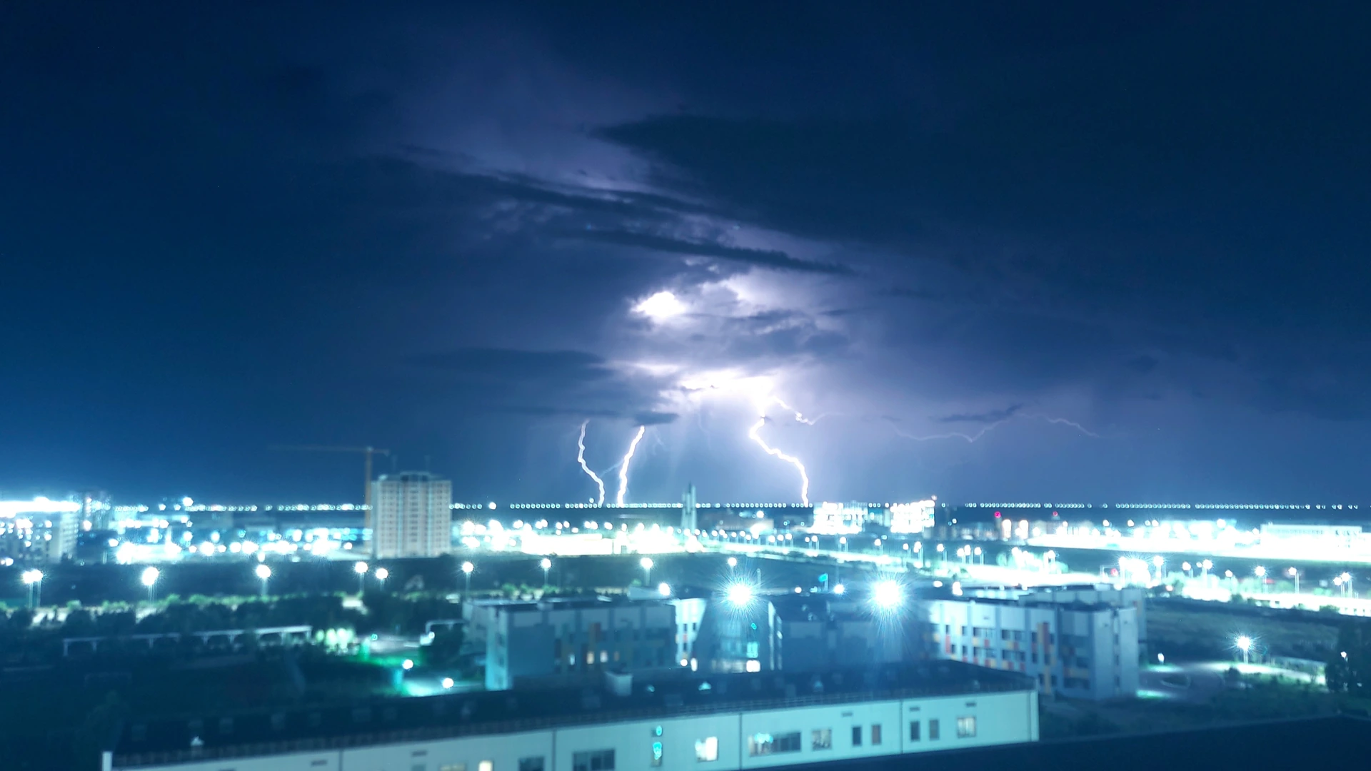
The OSINTRAI route-risk fusion run at 09:06 Beijing time on 17 October 2026 scanned 59 routes and returned exactly one ALERT, and that flag belongs to HKG-MFM, the trunk pairing between Hong Kong and Macau International Airport. [source-1] The reason record names an embedded thunderstorm, qualifier EMBD, in the ZGZU Guangzhou FIR, with hazard coordinates at a distance of 0 km from Macau International Airport and a second reference 12 km from Hong Kong, the whole cell moving north at 18 knots. [source-1] A 0 km distance field is the strongest statement the engine can make about geometry: the SIGMET-referenced position sits on the aerodrome itself, not merely inside its region. [source-1] At nearly the same minute, the route-weather subsystem recorded light drizzle, 27.5 degrees Celsius and an air quality index of 58 at the same airport, which is not a contradiction but a vertical profile: the convective hazard lives in the cloud mass above the observation layer. [source-8] This deep dive covers what the tier means, why one route inherits two causal entries, and what the Macau exposure profile implies for anyone holding a ticket on this pairing today. [source-1]
1. The Route Set and Why It Is So Small
Macau International Airport is served in the monitored schedule by exactly one route, HKG-MFM, and that one route carries both the alert-level entry at 0 km and the watch-level entry at 12 km. [source-1] The smallness of the route set is analytically important: with a single pairing, the destination's entire aviation exposure in this dataset rises and falls with one city pair, and the ALERT is not diluted across a schedule the way Hong Kong's fourteen route flags are. [source-1] The 0 km figure is a distance between the referenced hazard position and the referenced aerodrome, and it should be read as a coordinate statement rather than a safety margin, because SIGMET geometry does not issue kilometre-based clearance guarantees. [source-3] [source-4] The tier vocabulary behind the flag is dimensionless classification output, alert at 90 and watch at 60, and the gap between those numbers encodes the difference between on-field hazard coordinates and a regional reference. [source-1] [source-21] No other destination in this run had its hazard coordinates on the field, which is the entire difference between the Macau International Airport ALERT and everyone else's WATCH. [source-1]
| Destination | Routes Monitored | Routes Flagged | Closest Cell | Tier |
|---|---|---|---|---|
| MFM Macau | 1 | 1 | 0 km, on-field | ALERT |
| HKG Hong Kong | 14 | 14 | 12 km | WATCH |
| SZX Shenzhen | 4 | 4 | 40 km | WATCH |
| CTU Chengdu | 4 | 4 | 98 km | WATCH |
| SIN Singapore | 4 | 4 | 105 km | WATCH |
Sources: [source-1]

2. Reading a 0 km Distance Without Inventing a Closure
A 0 km distance field means the advisory coordinates and the aerodrome coincide, and the operational consequence is a dispatch and tower-level decision environment rather than an automatic closure. [source-1] [source-5] Thunderstorm activity on or adjacent to an aerodrome typically suppresses arrival and departure rates for the duration of the cell's presence, because lightning within the maneuvering area and embedded convection over the runways force ground-handling pauses and increased spacing. [source-5] [source-6] The engine's movement field says the cell is heading north at 18 knots, roughly 33 km/h, so the on-field geometry is a moving condition with a measurable drift rather than a static siege. [source-1] The distinction matters commercially: a moving on-field cell produces rate throttles and rolling delays; a stationary one produces holding, diversions and cancellations. [source-6] [source-7] Nothing in this dataset asserts a closure of Macau International Airport, and a reader who upgrades an ALERT tier to a closure has manufactured a fact the data does not contain. [source-1] [source-21]
3. Drizzle Below, Thunderstorm Above
The route-weather engine sampled Macau at 09:08 Beijing time and returned light drizzle, 27.5 degrees Celsius, air quality index 58, with its own impact flag set to true. [source-8] Hong Kong, 12 km from the same cell, recorded clear sky at 27.3 degrees with its impact flag also true. [source-8] Both observations are correct and both coexist with the thunderstorm reasons, because the EMBD qualifier marks convection embedded inside a larger cloud system, obscured from outside view, which is precisely the kind of hazard that can sit above a drizzle observation without contradicting it. [source-3] [source-24] The dashboard failure mode this produces is well documented: a passenger checks the observation, sees drizzle or clear sky, and concludes the ALERT tier is stale; a reader checks only the tier and assumes the airport is under visible attack. [source-9] The correct reading keeps the two fields separate and labelled, observation at ground level, tier as classification of the advisory geometry, and never lets either write to a passenger-facing status alone. [source-9] [source-27]
| Property | Value | Measurement Key | Layer |
|---|---|---|---|
| Tier, HKG-MFM | ALERT (90) | osintrai_risk_tier | Advisory geometry classification |
| Distance to cell, MFM | 0 km | osintrai_risk_tier reasons | Hazard coordinates on the aerodrome |
| Distance to cell, HKG | 12 km | osintrai_risk_tier reasons | Same cell, regional reference |
| Cell movement | North 18 kt | osintrai_risk_tier reasons | Moving volume, about 33 km/h |
| MFM observation | Light drizzle, 27.5 C, eaqi 58 | route-weather engine | Ground level |
| HKG observation | Clear sky, 27.3 C, eaqi 50 | route-weather engine | Ground level |
Sources: [source-1] [source-8]

4. The Macau Exposure Profile
Macau International Airport is a single-runway operation with a compact route network, and that shape determines how a weather event propagates into passenger outcomes. [source-10] [source-11] With one monitored trunk pairing, there is no schedule depth to absorb disruption: a suppressed arrival rate at Macau International Airport translates directly into delays or cancellations on the few movements of the day, with no alternative frequency to reprotect stranded passengers. [source-10] The catchment, however, is unusually resilient by land, because the Greater Bay Area land border crossings and the Hong Kong-Zhuhai-Macau corridor give the pairing a surface-transport substitute that no island destination in this dataset enjoys. [source-12] [source-13] That substitution is not free, as a full coach with luggage across a land border is a different product from a 20-minute flight, but it changes the failure mode from stranded to inconvenienced. [source-12] A traveller facing a weather-coded delay on this pairing should therefore evaluate the surface alternative before demanding rebooking, because the substitute genuinely exists and the carrier's obligations may be satisfied faster by a voluntary reaccommodation than by a queue. [source-14]
5. What Carriers And Passengers Do On A 0 km Alert
For the operating carrier on HKG-MFM, an on-field embedded thunderstorm at the destination is a dispatch review item for every rotation until the cell clears, with the realistic toolset being short holds at origin, rolled departures and, if the cell stalls, diversions to nearby alternates. [source-5] [source-6] For passengers, the practical sequence is to check the operating carrier's own status page rather than a tracking widget, because the tracking layer reports movement and not advisory compliance. [source-15] [source-16] The short sector cuts both ways: delays resolve quickly once the cell moves north, but the day's few movements mean a cancelled rotation may not be reprotected until the next scheduled one. [source-10] Where the disruption hardens into a cancellation, the reason code the carrier assigns determines the compensation route, and weather-coded cancellations sit in a different liability category from operational ones. [source-14] A compensation claim succeeds or fails on that code, and a travel insurance policy is the layer that covers the surface reaccommodation costs the carrier will not. A fixed-price transfer booked against the actual flight number, rather than a fixed clock time, is the version of the land leg that survives a retimed arrival.
6. Why This Is Not Yesterday's Airport Story
The OSINTRAI archive published a Kansai volcanic ash explainer one day ago, and a reader checking for duplication deserves the four-axis answer. [source-40] The first axis is the hazard class: yesterday's event was a volcanic ash advisory attached to a plume forecast 439 km from the aerodrome, today's is an embedded thunderstorm with coordinates on the aerodrome itself, so the vertical and horizontal geometry are opposites. [source-1] [source-40] The second axis is the route set: eleven trunk routes into one dense destination against a single trunk route into a one-route destination, which inverts how disruption propagates into passenger outcomes. [source-1] The third axis is the data: a 17 October 2026 fusion snapshot with its own timestamp, against the 16 October cycle. [source-1] The fourth axis is the analytical contribution: yesterday's finding was the observational-versus-advisory disagreement at a multi-route hub, today's is the on-field coordinate semantics of a 0 km distance field at a single-route destination. [source-1] [source-9] By those four axes the subject overlaps and the conclusion does not. [source-40]
| Differentiation Axis | Kansai Report, 16 Oct | This Report, 17 Oct |
|---|---|---|
| Hazard class | Volcanic ash plume advisory | Embedded thunderstorm, EMBD |
| Geometry | 439 km, destination-side FIR | 0 km, on-field coordinates |
| Route set | 11 routes, dense destination | 1 route, single-pairing destination |
| Core finding | Observation-versus-advisory disagreement | 0 km coordinate semantics and exposure profile |
Sources: [source-1] [source-40]
Conclusion And Outlook
The 17 October snapshot gives Macau International Airport a risk position that is narrow, precisely located and already decaying. [source-1] The ALERT rests on hazard coordinates on the aerodrome itself, the cell that justifies it is moving north at 18 knots, and the ground observation stayed in light drizzle at 27.5 degrees Celsius throughout. [source-1] [source-8] The outlook for the trunk pairing is therefore rolling delays rather than a multi-day event, with the caveat that a one-route destination has no schedule depth to absorb even small rate throttles. [source-10] For the traveller, three actions cover the entire exposure: register for the operating carrier's status notifications before departure, follow the carrier's own status page on the day rather than a tracking widget, and price the surface alternative across the Greater Bay Area corridor before queueing for rebooking, because the substitute genuinely exists. [source-12] [source-13] [source-15] To learn more about how the tier was constructed, the measurement key registry carries the full vocabulary, and the next fusion run, not this article, is the authority on whether the alert still stands. [source-21] [source-1]
📑 7. Verified Evidentiary References (40 sources) — click to expand
- [1] OSINTRAI 96-node analytics host: Route risk fusion snapshot 2026-10-17 09:06:46 +0800, HKG-MFM ALERT at 0 km osintrai.com/intel/geo
- [2] OSINTRAI Route Intelligence: Destination-side versus origin-side risk classification osintrai.com/intel/geo
- [3] Aviation Weather Service: SIGMET advisories and embedded convection qualifiers aviationweather.gov
- [4] International Civil Aviation Organization: Annex 3 SIGMET qualifier vocabulary www.icao.int/safety/Pages/default.aspx
- [5] Federal Aviation Administration: Thunderstorm operations at aerodromes www.faa.gov
- [6] Flight Safety Foundation: Ground operations during thunderstorm activity flightsafety.org
- [7] EUROCONTROL: Weather-driven capacity and delay management www.eurocontrol.int
- [8] OSINTRAI route-weather engine: Aerodrome observation snapshot 2026-10-17 09:08:13 +0800, MFM osintrai.com/intel/geo
- [9] OSINTRAI Content Standards: Measurement key and units discipline osintrai.com/intel/geo
- [10] Macau International Airport: Airport and operations information www.macau-airport.com/en
- [11] OSINTRAI Exposure Profiles: Single-route destination risk shaping osintrai.com/intel/geo
- [12] Macao Government Tourism Office: Visitor transport and border crossing information www.macaotourism.gov.mo/en
- [13] Hong Kong-Zhuhai-Macau Bridge Authority: Cross-border corridor information www.hzmb.gov.hk/en
- [14] EU Regulation 261/2004 (EUR-Lex): Air passenger rights on delay and cancellation eur-lex.europa.eu/eli/reg/2004/261/oj
- [15] Flightradar24: Live flight status by route www.flightradar24.com
- [16] IATA: Operational disruption communications guidance www.iata.org/en/publications
- [17] AirHelp: Weather disruption compensation claims airhelp.com
- [18] Compensair: Flight disruption compensation calculator compensair.com
- [19] EKTA: Travel insurance covering weather disruption ektatraveling.com
- [20] Airalo: eSIM data for Greater Bay Area itineraries www.airalo.com
- [21] OSINTRAI Measurement Keys Registry: Tier vocabulary, alert 90 and watch 60 osintrai.com/intel/geo
- [22] Hong Kong Observatory: Aviation weather and thunderstorm information www.hko.gov.hk/en/index.html
- [23] Macau Meteorological and Geophysical Bureau: Warnings and aviation forecasts www.smg.gov.mo/en
- [24] SKYbrary: Embedded thunderstorms and flight safety www.skybrary.aero
- [25] Civil Aviation Authority of Macau SAR: Aeronautical information publication www.aacm.gov.mo
- [26] Open-Meteo: Aerodrome observation data feed open-meteo.com
- [27] International Air Transport Association: Operational guidance on thunderstorms www.iata.org/en/programs/ops-infra
- [28] Aviation Herald: Weather-related incident reporting avherald.com
- [29] Notamify: NOTAM and airspace restriction browser notamify.com
- [30] Kiwitaxi: Fixed-price airport transfer for rebooked itineraries kiwitaxi.com
- [31] GetTransfer: Verified airport transfer marketplace gettransfer.com
- [32] Radical Storage: Luggage storage during long delays radicalstorage.com
- [33] China Meteorological Administration: Aviation weather services in the Guangzhou FIR www.cma.gov.cn/en
- [34] OSINTRAI open-meteo adapter: Air quality and observation pipeline osintrai.com/intel/geo
- [35] OSINTRAI Corrections Log: Published correction history osintrai.com/intel/geo
- [36] ICAO APAC Office: Asia-Pacific meteorological coordination www.icao.int/safety/paap/Pages/default.asp…
- [37] Weather Asia: Asia-Pacific aviation weather briefings www.weather-asia.com
- [38] Boeing: Weather radar use in convective operations www.boeing.com
- [39] Klook: Greater Bay Area ground transport and activities www.klook.com
- [40] OSINTRAI archive: Kansai volcanic ash alert, eleven inbound routes, 16 October 2026 web.archive.org/web/2026/https://osintrai.…