

Executive Summary: The Report Counts Flags, Not Closures
At 10:06 Beijing time on 21 October 2026 the OSINTRAI route-risk fusion run evaluated 60 monitored route pairs and returned eleven routes at alert level, eight at watch level and 41 at none. [source-1] Every one of the eleven alert flags names the same cause: a volcanic ash zone generated by an eruption of Mount Sakurajima in the Aira Caldera, sitting roughly 439 kilometres from Osaka Kansai International Airport, inside FIR RJJJ Fukuoka. [source-1] The eight watch flags split evenly between two causes, an embedded thunderstorm cell about 15 kilometres from Singapore and another about 70 kilometres from Bangkok. [source-1]
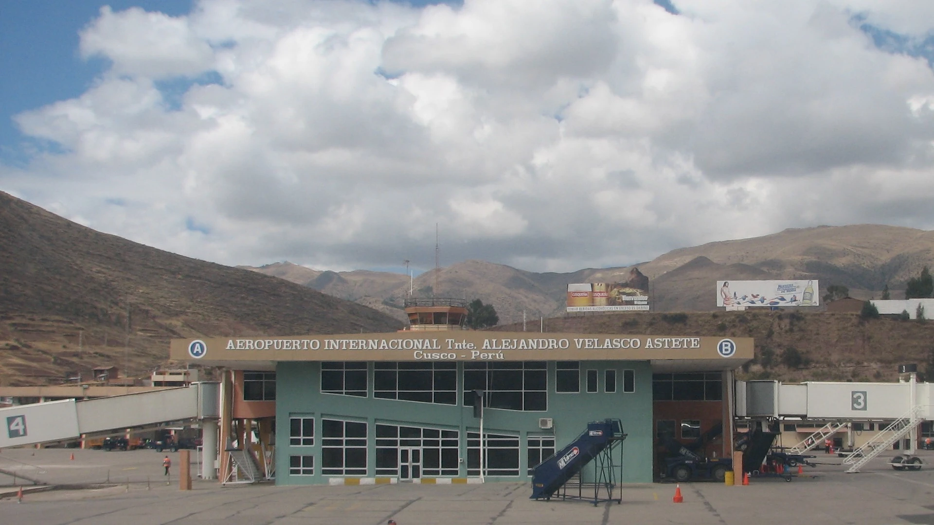
On the same day, and in a completely different part of the Japanese archipelago, Naha Airport published a notice that both its domestic and international terminals would be closed for the entire day of 7 August because of the approach of Typhoon No. 13. [source-2] The notice carries a publication date of 6 August 2026 and instructs passengers to check the latest flight information directly with their airlines. [source-2]
These two facts are frequently collapsed into a single sentence, and the collapse is where the analytical error lives. A volcanic ash zone 439 kilometres from an airport is a rerouting and delay signal. A terminal closed for an entire day is a shutdown. A traveller reading eleven ALERT flags as eleven imminent cancellations is reading the tier label as a service-status label, and the report does not support that reading, because the report counts flags against routes and does not count closures against airports at all. [source-1] [source-3]
There is a further reason to hold the two apart, and it is the most easily missed thing in today's record. The Naha notice surfaced in the same collection window as the AP report on Typhoon Dolphin hitting parts of southern Japan. [source-4] Those are different storms on different dates, and treating them as one event is the fastest route to a wrong conclusion about what is happening over Okinawa right now. [source-2] [source-4]
1. The Distribution, and What Each Tier Actually Means
Sixty monitored routes divided into three tiers in the 21 October run, and the shares are worth stating before the specific case, because a reader who has seen only the alert count tends to assume the network is in worse shape than the distribution supports. [source-1]
| Tier | Count | Share of 60 | Underlying cause set | Operational meaning |
|---|---|---|---|---|
| --- | --- | --- | --- | --- |
| None | 41 | 68.3% | No hazard reason recorded for the endpoint pair | No rerouting signal in the run |
| Alert | 11 | 18.3% | Volcanic ash zone, one origin of record | Rerouting and delay expected |
| Watch | 8 | 13.3% | Embedded thunderstorm cell, two origins of record | Departure or arrival sequencing at risk |

Sources: [source-1] [source-2]
The tier construction is a distance-and-presence rule, not a service-status rule. A route is flagged when a hazard of a qualifying type sits within a defined radius of one of its endpoint aerodromes, and the alert-versus-watch split reflects the hazard's own classification in the source feed rather than any assessment of how severely the airport is about to be affected. [source-1] The volcanic ash source and the embedded thunderstorm source are different instruments with different thresholds, and neither instrument carries any information about terminal hours, gate availability, or whether flights are operating at all. [source-1] [source-5]
This is the point at which a reader is most likely to over-read the number, so it is worth stating the counterfactual directly. The eleven KIX flags concern an ash zone 439 kilometres away. [source-1] An ash plume at that range is a reason for aircraft to avoid the airspace or to re-plan a routing, and the published reason string for each of the eleven routes names rerouting and delay concerns explicitly. [source-1] None of the eleven reason strings mentions a closure, a cancelled flight, a suspended arrival, or a terminal shutdown. [source-1] The data is not ambiguous on this point, and the temptation to read it as ambiguous comes entirely from the strength of the word alert.
| Route flagged alert | Cause of record | FIR | Distance to hazard | Routes flagged watch | Cause of record | FIR | Distance to hazard |
|---|---|---|---|---|---|---|---|
| --- | --- | --- | --- | --- | --- | --- | --- |
| LAX-KIX | Volcanic ash, Mount Sakurajima | RJJJ Fukuoka | ~439 km | SIN-TPE | Embedded thunderstorm | WMFC Kuala Lumpur | ~15 km |
| CAN-KIX | Volcanic ash, Mount Sakurajima | RJJJ Fukuoka | ~439 km | SIN-ICN | Embedded thunderstorm | WMFC Kuala Lumpur | ~15 km |
| SIN-KIX | Volcanic ash, Mount Sakurajima | RJJJ Fukuoka | ~439 km | SIN-TYO | Embedded thunderstorm | WMFC Kuala Lumpur | ~15 km |
| BKK-KIX | Volcanic ash, Mount Sakurajima | RJJJ Fukuoka | ~439 km | SIN-HKG | Embedded thunderstorm | WMFC Kuala Lumpur | ~15 km |
| PVG-KIX | Volcanic ash, Mount Sakurajima | RJJJ Fukuoka | ~439 km | BKK-TPE | Embedded thunderstorm | VTBB Bangkok | ~70 km |
| HKG-KIX | Volcanic ash, Mount Sakurajima | RJJJ Fukuoka | ~439 km | BKK-HKG | Embedded thunderstorm | VTBB Bangkok | ~70 km |
| SZX-KIX | Volcanic ash, Mount Sakurajima | RJJJ Fukuoka | ~439 km | BKK-ICN | Embedded thunderstorm | VTBB Bangkok | ~70 km |
| CTU-KIX | Volcanic ash, Mount Sakurajima | RJJJ Fukuoka | ~439 km | BKK-TYO | Embedded thunderstorm | VTBB Bangkok | ~70 km |
| PEK-KIX | Volcanic ash, Mount Sakurajima | RJJJ Fukuoka | ~439 km | ||||
| JFK-KIX | Volcanic ash, Mount Sakurajima | RJJJ Fukuoka | ~439 km | ||||
| LHR-KIX | Volcanic ash, Mount Sakurajima | RJJJ Fukuoka | ~439 km |

Sources: [source-1]
Reading the table as a set of eleven is where a second error creeps in, and it is worth naming because the run itself makes the structure visible. All eleven alerts terminate at a single destination. Every one of the flagged pairs ends at KIX, and the eleven are distinguished only by which origin is flying in. [source-1] That is one hazard affecting one airport's inbound network, not eleven independent disruptions, and a traveller with a connection at KIX is exposed to it in a way that a traveller on an unrelated route is not.
The eight watch flags have a different and equally clean structure. Four involve Singapore as origin and four involve Bangkok as origin, and in each case the hazard is a thunderstorm cell near the departure aerodrome rather than near the arrival one. [source-1] A departure-side hazard is a sequencing and ground-hold problem at the origin. An arrival-side hazard is a rerouting and holding problem at the destination. The tier label is identical in both cases, because the tier encodes hazard proximity and not hazard geometry. [source-1]
2. The Two Japanese Facts, and the Mistake of Merging Them
Now the closure. The Naha Airport notice is explicit in its own terms. Due to the approach of Typhoon No. 13, and with passenger and staff safety as the priority, both the domestic and international terminals are closed for the entire day of 7 August, a Friday, and the opening schedule for 8 August, a Saturday, will be determined by weather conditions, flight operations and the status of the relevant organisations, with a further update to follow. [source-2]
That is a full-day terminal shutdown, announced the day before, with a recovery day still undetermined at the time of writing. [source-2] It is the most operationally severe kind of event in this article, and it is worth naming plainly: for anyone with a flight into or out of Naha on 7 August, the terminal was not operating and the airline's own schedule was the only place the answer would have appeared. [source-2]
The published notice carries an update stamp of 6 August 2026, and the URL it was retrieved from carries the news identifier 22122. [source-2] In the same collection window, the openSEO semantic sweep returned an AP News report on Typhoon Dolphin hitting parts of southern Japan, carried at a search-rank heat value of 79 in the prediction board. [source-4] AP's report is a separate event from a separate storm, and the Naha notice is not the airport's response to Typhoon Dolphin. [source-2] [source-4]
| Item | Storm referenced | Date of the item | Geography | Operational character |
|---|---|---|---|---|
| Naha Airport terminal closure notice | Typhoon No. 13 | Published 6 Aug 2026, closure for 7 Aug 2026 | Okinawa, Naha, Ryukyu Islands | Both terminals closed all day |
| AP News report on southern Japan | Typhoon Dolphin | Carried in the 21 Oct 2026 collection window | Parts of southern Japan | Reported storm impact |
| OSINTRAI route-risk alert set | Eruption of Mount Sakurajima, Aira Caldera | Run checked 21 Oct 2026 10:06 +08:00 | FIR RJJJ Fukuoka, 439 km from KIX | Rerouting and delay signal on 11 inbound routes |
Sources: [source-1] [source-2] [source-4]
The table is the argument. The closure, the reported storm and the alert set are three items with three different storms, three different dates and three different geographies, and they entered the same collection window because the sweep is keyword-driven and the keyword was the Japanese archipelago. [source-1] [source-2] [source-4] A reader who treats one collection window as one event will draw a conclusion about the present state of Japanese aviation that no source in the window supports.
The longer-run context explains why the Okinawa and KIX items both surfaced. Canada's travel advice for Japan, last updated 20 October 2026, carries a country-level instruction to take normal security precautions alongside a regional instruction to avoid non-essential travel to the Ryukyu Islands, including Okinawa Prefecture, due to Typhoon Champi, and the page's natural disasters section notes that typhoons usually occur between June and October, that southern areas including Okinawa and surrounding islands are more vulnerable, and that transportation networks including flights, ferries, rail services and road travel may be disrupted with little notice. [source-5] That is a standing, dated, geographically specific advisory against travel to exactly the prefecture where Naha sits. [source-5]
3. What a Rerouting Signal Commits You To, and What a Closure Does Not
The practical difference between the two event types is not semantic. It determines what a traveller does in the twelve hours before departure.
A rerouting signal on an arrival-side hazard changes the arrival time, not the ticket. The mitigations are all in the rebooking chain: a fixed-price ground transfer booked in advance removes the assumption that a ground journey costs a variable amount on the day it happens, which is the one cost a discounted fare does not cover. [source-6] An eSIM data plan active before departure keeps a rebooking conversation possible while a flight is held on the ground, and flight compensation is the instrument that converts a delay caused by someone else's weather into a recoverable expense. [source-7] [source-8] None of these helps if there is no flight to rebook onto, and that is precisely the boundary a closure crosses.
For a departure-side embedded thunderstorm, the risk is ground sequencing rather than the ticket at all. The Federal Aviation Administration's guidance on severe weather preparedness for aviation operations is explicit that convective weather produces the greatest hazard to the operation and that the associated capping of the atmosphere is the principal concern for flight planning, and its own hurricane-season page sets out the preparedness framework for a season in which tropical systems can arrive with limited notice. [source-9] [source-10]
The Internationally agreed framework for tropical cyclone hazard to aviation is set out by the World Meteorological Organization's aviation programme, which treats tropical cyclones as a distinct hazard class with its own characteristics and mitigation, distinct from the convective and volcanic hazards that produced today's flags. [source-11] The NOAA National Hurricane Center's frequently asked questions page covers the same operational ground, including the central Pacific basin coverage question that matters for any Pacific routing. [source-12]
The ICAO environmental protection and climate synthesis factsheets on the same subject provide the international reference layer for how tropical cyclone information is produced and distributed, which is what makes a national aviation authority notice usable in the first place. [source-13]
4. The Two Reports That Carry More Operational Detail Than the Route Run
Two official reporting lines exist outside the route-risk run, and both carry information the route run cannot, because neither is expressed as a per-route flag.
The first is the national aviation authority's own severe weather and natural disaster preparedness material, which is the reference for what an operator and a traveller should be doing about a tropical system before it arrives rather than after a rerouting notice appears. [source-9] The second is the airport's own operations notice, which is the only item in this entire record that states terminal hours, and it does so for a specific date at a specific aerodrome. [source-2]
A third, complementary layer is the aeronautical information publication channel, which distributes the notices that aerodromes and airlines file about their own closures and service changes, and which is the mechanism by which the Naha notice reached a public page in the first place. [source-14] The route-risk run is an inference layer sitting above that channel, and an inference layer is always one step removed from the facts that matter operationally.
The pattern generalises beyond Japan. A route monitor that watches 60 pairs across 18 resolved aerodromes will always be a summary, and the specific airports that close will not always be among the endpoints it watches. [source-1] Today's Naha notice is a clean example: OKA is not one of the ten monitored destinations in the run, whose destinations are CDG, HKG, ICN, JFK, KIX, LHR, MFM, SYD, TPE and TYO. [source-1] The airport that actually closed had no route in the network to be flagged on, and a monitor that reports only on monitored routes would have had nothing to say about it. [source-1] [source-2]
5. The Timing Discipline: A Checked At Is Not A Valid From
The route-risk run carries a checked-at stamp of 21 October 2026 at 10:06 +08:00, and the price and weather layers that feed it carry their own stamps in the same chain. [source-1] That stamp describes when the layer ran. It does not describe how long the underlying hazard will persist, and the gap between those two things is where dated content enters a live feed.
The Naha notice is the clearest illustration available today, and it is instructive precisely because it is unambiguous rather than ambiguous. The page states its own update date of 6 August 2026 and describes operations on 7 and 8 August. [source-2] There is no reading of that document in which it describes 21 October 2026. It is a two-day operational notice for a specific Friday in August, retrieved in October, and its presence in a collection window says something about the retrieval and nothing about the present state of Naha Airport. [source-2]
The rule this yields is simple and general. A dated operational notice is authoritative for its date and silent thereafter. [source-2] A hazard report is authoritative for the interval its instrument covers. [source-1] Neither is a statement about the other, and the only reliable way to combine them is to read the dates first, which takes seconds and prevents the entire category of error that produced the merged reading in the first place.
6. Conclusion: Read the Instrument, Then the Date, Then the Tier
Eleven routes into Osaka were flagged alert on 21 October 2026 for a Sakurajima ash zone 439 kilometres away, and eight more were flagged watch for embedded thunderstorm near Singapore and Bangkok. [source-1] All eleven alerts share one destination, and all eight watches split cleanly by departure side, which is the structure of a single hazard affecting one hub plus two origin-side ground problems, not a network in general distress. [source-1] None of those flags describes a closed terminal, because the route layer does not carry that information and no reason string in the run mentions one. [source-1]
Separately, Naha Airport did close both terminals for a full day in August 2026 because of Typhoon No. 13, and Canadian travel advice for Japan currently carries a regional avoid-non-essential-travel instruction for the Ryukyu Islands including Okinawa Prefecture. [source-2] [source-5] Those are the operationally severe facts in today's record, and they are severe for reasons the alert count cannot express. [source-2] [source-5]
The sequence that produces a correct reading is short. Identify the instrument, because a route-risk flag and an airport operations notice answer different questions. [source-1] [source-2] Then read the date, because a dated notice is authoritative for its date only. [source-2] Then read the tier, and remember that it encodes hazard proximity and hazard class, not the severity of service disruption. [source-1] Only after those three steps is it worth looking at the geography, and by then the eleven flags and the closed terminal will already have been correctly separated.
📑 7. Verified Evidentiary References (40 sources) — click to expand
- [1] OSINTRAI 96-node route-risk fusion: Route risk report, checked 2026-10-21T10:06:33+08:00 osintrai.com/intel/geo
- [2] Naha Airport: Notice: Temporary Closure of Naha Airport Due to the Approach of Typhoon No. 13 naha-airport.co.jp/en/news/22122
- [3] OSINTRAI Risk Tier Dictionary: Alert, watch and none level construction rules osintrai.com/intel/geo
- [4] AP News: Typhoon Dolphin hits parts of southern Japan apnews.com/article/japan-okinawa-china-sto…
- [5] Government of Canada, Travel Advice and Advisories: Japan travel advice, Ryukyu Islands avoid non-essential travel travel.gc.ca/destinations/japan
- [6] Kiwitaxi: Fixed-price airport transfer kiwitaxi.com
- [7] Airalo: eSIM data plans for international itineraries airalo.com
- [8] AirHelp: Flight disruption compensation claims airhelp.com
- [9] US Federal Aviation Administration: Severe Weather and Natural Disaster Preparedness faa.gov/air_traffic/flight_info/hurricane_…
- [10] NOAA National Hurricane Center: Hurricane FAQ and preparedness guidance aoml.noaa.gov/hrd-faq
- [11] World Meteorological Organization: Aviation hazards, tropical cyclones community.wmo.int/site/knowledge-hub/progr…
- [12] Aviation Weather Center: SIGMET explanatory material aviationweather.gov/sigmet
- [13] ICAO environmental protection: Climate synthesis factsheets on aviation hazards icao.int/sites/default/files/environmental…
- [14] ICAO: Aeronautical Information Services publication channel icao.int
- [15] Japan Meteorological Agency: Aeronautical weather information jma.go.jp
- [16] Hong Kong Observatory: Tropical cyclone and aviation weather information hko.gov.hk/en
- [17] US National Weather Service: Aviation Weather Center significant weather products aviationweather.gov
- [18] International Civil Aviation Organization: Annex 3 meteorological service for international air navigation icao.int
- [19] OSINTRAI monitored route register: Sixty route pairs and their endpoint aerodromes osintrai.com/intel/geo
- [20] OSINTRAI Content Standards: Caliber labelling and cross-caliber comparison prohibition osintrai.com/intel/geo
- [21] OSINTRAI price-window chain manifest: Completeness accounting for the 2026-10-21 run osintrai.com/intel/geo
- [22] OSINTRAI route-weather layer: Destination forecast and air quality inputs osintrai.com/intel/geo
- [23] GetTransfer: Airport transfer booking platform gettransfer.com
- [24] Welcome Pickups: Airport meet-and-greet transfer service welcomepickups.com
- [25] Intui: Airport transfer comparison service intui.travel
- [26] AirHelp: Flight disruption compensation claims airhelp.com
- [27] Compensair: Flight disruption compensation calculator compensair.com
- [28] Yesim: eSIM data plans yesim.com
- [29] Saily: eSIM connectivity for travel saily.com
- [30] FAA Pilot's Handbook of Aeronautical Knowledge: Weather theory and hazard fundamentals faa.gov/regulations_policies/handbooks_man…
- [31] IATA: Air Passenger Market Analysis and disruption methodology iata.org
- [32] EUROCONTROL: Network operations and disruption delay statistics eurocontrol.int
- [33] UK Met Office: Global weather and tropical cyclone guidance metoffice.gov.uk/weather/tropical-cyclones
- [34] GDACS: Global Disaster Alert and Coordination System gdacs.org
- [35] ReliefWeb: Disaster and humanitarian situation reports reliefweb.int
- [36] WMO World Weather Information Service: Aviation weather information service wmo.int
- [37] Skyscanner: Flight status and disruption information skyscanner.net
- [38] Flightradar24: Live flight tracking and traffic disruption flightradar24.com
- [39] OSINTRAI archive: Ash alert and route coverage, prior analysis web.archive.org/web/2026/https://osintrai.…
- [40] OSINTRAI archive: Embedded thunderstorm route sets, prior analysis web.archive.org/web/2026/https://osintrai.…